Analytical Infrastructure and Research Facilities
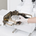
The Laboratory of Sample Preparation constitutes the primary mechanical and physical processing stage within the analytical pipeline. It converts macro-scale, unweathered lithological field specimens into highly constrained, precise geometries and grain separates required for optical petrography, bulk-rock geochemistry, and micro-beam mass spectrometry.
Core Methodological Sub-Units and Capabilities:
• Mechanical Comminution & Sizing (Rock Sawing): Equipped with heavy-duty diamond-blade circular and precision trim saws designed to isolate unaltered rock matrices. This process mechanically strips outer weathered surfaces to eliminate surficial contamination prior to downstream processing.
• Ultra-Fine Pulverization (Rock Powdering): Utilizes primary jaw crushers followed by specialized agate and tungsten carbide planetary ball mills. Samples are reduced to a homogeneous whole-rock powder (<60 μm) optimal for X-ray Fluorescence (XRF) and Inductively Coupled Plasma Mass Spectrometry (ICP-MS) configurations.
• Petrographic Thin Section Fabrication: Incorporates automated precision lapping, grinding, and polishing systems. This unit produces standard petrographic thin sections calibrated to a uniform thickness of 30 μm for polarized light optical microscopy, as well as highly polished, flat-surface epoxy pucks necessary for electron-beam microanalysis.
• Mineral Separation (Geochronological Processing): Employs an integrated processing line consisting of wet-shaking tables (Wilfley tables), density-gradient heavy liquids, and Frantz isodynamic magnetic separators. This workflow isolates pure heavy mineral fractions—primarily zircon, monazite, apatite, and titanite—essential for U-Pb and specialized isotopic geochronology.
Pomeroy Rock Coring Drills (Gasoline-Powered Field Hand-Drilling)
To obtain pristine, structurally oriented sub-surface core samples from remote outcrops across Mongolia’s complex terrain, researchers deploy Pomeroy Rock Coring Drills (such as the Pomeroy EZ Core D261-C series):
• The Hardware: These portable field hand-drilling machines are heavily modified from lightweight, high-performance Stihl two-stroke gasoline engine blocks. They are engineered with customized omni-directional fuel pick-up configurations, allowing the operator to drill smoothly at any angle—horizontal, vertical, or angled into a cliff face.
• Core Extraction: Using water-lubricated diamond core drill bits powered by manual, pressurized water-can cooling pumps, they extract highly uniform 1-inch to 1⅛-inch diameter rock cylinders directly from dense igneous, metamorphic, or sedimentary basements.
2. Paleomagnetic Orientation and Structural Context
Taking the core out of the rock is only half the battle; its exact position in the earth must be logged before it is broken free. Field teams couple the Pomeroy drill with specialized field fixtures:
• Core Orienting Fixtures: Before snapping the core sample from the outcrop using a slot-chisel, a specialized Pomeroy orienting fixture is slid over the in-situ cylinder.
• Azimuth & Dip Mapping: Geologists fix a Brunton pocket transit or a sun compass directly onto the orienting wand to accurately measure the precise magnetic/solar azimuth and structural dip of the core axis.

The Institute of Geology warmly welcomes international and domestic research institutes, academic organizations, and industry partners for scientific collaboration.
Useful Links
Contact
© Institute of Geology